
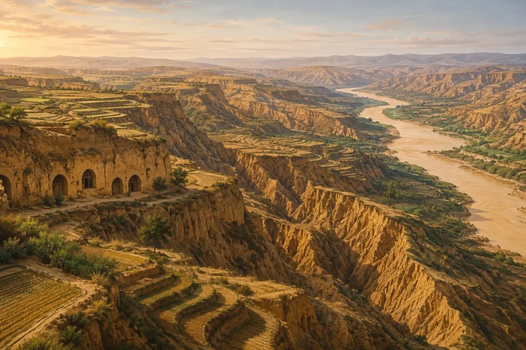
Across north-central China lies a landscape built from dust. Over immense spans of time, winds deposited layer upon layer of fine yellow silt, creating the Loess Plateau. Its soil could be cultivated and carved with unusual ease, yet it could also be stripped away by rain with devastating speed. That combination—fertility and fragility—shaped farming, settlement, architecture, river management, and state policy across northern China.
A landscape made by wind
Loess is a fine, silt-rich sediment carried and deposited by wind. During the Quaternary period, dust from the dry interior of Asia accumulated across the plateau in thick sequences. Repeated changes in climate and monsoon strength produced alternating layers of loess and ancient soils, turning the region into a remarkable record of past environments.
Later erosion cut this soft material into steep walls, narrow ridges, broad tablelands, and dense networks of ravines. The plateau therefore contains two histories at once: deposition created its mass, while water and human land use helped carve its dramatic surface.
Fertile soil, fragile slopes
Loess can hold moisture and nutrients, and its loose texture is relatively easy to work. These qualities made cultivation possible across a region with cold winters, limited rainfall, and few naturally level fields. Farmers grew crops adapted to northern China, especially grains such as millet and, in many areas, wheat.
Yet the same fine texture made exposed slopes highly vulnerable. Intense rain could break the soil apart and carry it into gullies. When vegetation was removed and steep ground was cultivated or heavily grazed, runoff accelerated. Productive earth could disappear downstream in a single storm, leaving deeper ravines and poorer fields behind.
Farming reshaped the terrain
People responded by engineering the land. Terraces turned slopes into steps, reduced the speed of runoff, and created flatter surfaces for crops. Small dams and embankments trapped sediment and water. Villages clustered where valleys, springs, roads, and cultivable ground made life possible.
These adaptations supported settled communities, but they also required constant maintenance. A terrace was not a permanent victory over erosion; walls had to be repaired, drainage managed, and soil fertility protected. On the Loess Plateau, agriculture became an ongoing negotiation between human labor and mobile earth.
The earth became architecture
The plateau shaped not only fields but homes. In many districts, people created yaodong dwellings by cutting arched rooms into loess cliffs or excavating rooms around sunken courtyards. Thick surrounding earth moderated temperature, helping interiors remain warmer in winter and cooler in summer.
This architecture used the most abundant local material without first turning it into timber or fired brick. Its forms followed the plateau’s slopes, walls, and flat-topped surfaces. The result was a distinctive built environment in which the boundary between landscape and dwelling became unusually thin.
The plateau entered the Yellow River
Water carried eroded loess into streams and then into the Yellow River. The suspended sediment helped give the river its famous color and historically contributed to extraordinarily heavy sediment loads. Downstream, deposited silt could raise channels and complicate flood control, linking land use on the plateau to the safety of communities far away.
This connection transformed erosion from a local farming problem into a regional political challenge. Managing the Yellow River required attention not only to levees and channels on the plains, but also to hillsides and watersheds upstream. The plateau and the river formed one environmental system, even where administration treated them as separate places.
Restoration at the scale of a landscape
By the late twentieth century, severe erosion and rural poverty had become deeply intertwined in parts of the plateau. Large restoration programs combined terracing, revegetation, restrictions on uncontrolled grazing, check dams, and changes in where crops were grown. The goal was not simply to plant trees, but to reorganize land use around the capabilities of each slope and watershed.
World Bank-supported rehabilitation projects reported higher agricultural productivity, greater vegetation cover, reduced sediment loss, and improved livelihoods for millions of people. The results made the Loess Plateau an influential example of large-scale ecological restoration. They also showed that environmental recovery could depend on institutions, incentives, and cooperation as much as on engineering.
A modern balance between soil and water
Restoration does not end the plateau’s environmental tensions. Vegetation can stabilize soil, but plants also consume scarce water. Terraces and dams can reduce erosion, but they alter runoff and sediment movement. Rural communities still need productive land and income while governments seek cleaner rivers, safer slopes, and healthier ecosystems.
The modern significance of the plateau therefore lies in balance. Decisions about crops, grazing, forests, water, and settlement must be made together. The landscape remains a living test of whether long-term ecological security can be combined with the needs of the people who inhabit it.
The dust that shaped civilization
The Loess Plateau shows how one material can guide many dimensions of civilization. Windblown soil supported crops, invited excavation, supplied the Yellow River with sediment, and demanded generations of labor to keep fields from washing away. It influenced where people lived, how they built, and how governments understood the connection between uplands and plains.
Human communities transformed the plateau through farming, settlement, and restoration, but the plateau continually set the terms of that transformation. Its history is written in dust: easily shaped, easily lost, and powerful enough to connect a hillside field with the course of one of Asia’s great rivers.
Further reading: World Bank: Restoring China’s Loess Plateau; FAO AGRIS: Soil erosion and its control in the Loess Plateau of China; NASA JPL: The Yellow River and sediment from the Loess Plateau.
 Intellesia
Leave a comment