
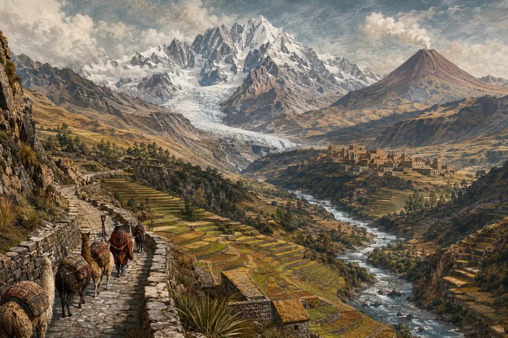
The Andes form a mountainous spine along the western edge of South America. Their peaks, plateaus, valleys, volcanoes, and glaciers create extraordinary differences in altitude over short horizontal distances. These mountains did more than obstruct movement. They divided climates into vertical zones, concentrated water, exposed mineral wealth, and forced societies to solve the problems of farming, travel, and government on steep and unstable ground.
A continental spine built by subduction
The Andes extend for more than 7,000 kilometers along South America’s Pacific margin. Their formation is closely tied to the subduction of oceanic plates—especially the Nazca Plate—beneath the South American Plate. Compression has thickened and uplifted the continent’s western edge, while magma generated above the descending plate has fed a long chain of volcanoes.
This tectonic setting remains active. Earthquakes, eruptions, landslides, and continuing deformation are not interruptions to an otherwise finished landscape; they are evidence that the range is still being made. The same geological processes that created high plateaus and fertile volcanic soils also produced persistent hazards and many of the mineral deposits that later attracted states and industries.
Altitude created vertical worlds
In the Andes, a journey uphill can resemble a journey across latitudes. Warm valleys and forested slopes give way to temperate basins, cold grasslands, high plateaus, and finally rock, snow, and ice. Rainfall also varies sharply. Moist air may feed cloud forests on one side of a range while rain shadows contribute to extreme dryness on the other.
These stacked environments encouraged what scholars often describe as vertical economies. Communities sought access to products from several elevation zones rather than relying on a single landscape. Maize, tubers, grazing animals, salt, coca, timber, and marine goods could circulate between ecological levels, linking settlements that were close on a map but separated by steep ascents and difficult trails.
Farming climbed the slopes
Andean farmers transformed steep terrain through terraces, raised fields, irrigation channels, and careful selection of crops adapted to different altitudes. Terraces created level soil, reduced erosion, managed water, and moderated local growing conditions. Across generations, farmers developed an exceptionally diverse agricultural system in which risk could be spread among fields, elevations, and crop varieties.
The Andes became a major center of domestication. Potatoes, quinoa, and other native crops were shaped by millennia of cultivation, while llamas and alpacas provided fiber, meat, transport, and manure. This was not simply survival in a hostile environment. It was the construction of productive landscapes through detailed knowledge of frost, rainfall, soils, slopes, and seasonal change.
Roads turned height into political power
Mountain terrain made wheeled transport impractical across much of the pre-Hispanic Andes, but it did not prevent large-scale communication. Paths, stairways, bridges, way stations, and storage facilities connected communities across high passes and deep valleys. Human porters and llama caravans moved food, textiles, messages, and state resources through terrain that demanded endurance and organization.
The Inca expanded earlier routes into the Qhapaq Ñan, a road network extending more than 30,000 kilometers. It linked centers of production, worship, administration, and defence across environments ranging from snowy peaks to deserts and forests. Roads allowed the state to move officials and armies, collect resources, maintain storehouses, and govern an empire whose geography resisted simple centralization.
Mountains divided communities—and connected them
Ridges and canyons could isolate neighboring valleys, encouraging linguistic, political, and cultural diversity. Travel might require climbing thousands of meters before descending to a destination that appeared nearby. Local knowledge of passes, weather, and water therefore mattered as much as straight-line distance.
Yet the Andes also concentrated settlement in basins and valleys where water and cultivable land were available. Markets, pilgrimage routes, seasonal labor, and exchange networks tied those places together. Civilizations such as Tiwanaku, Wari, and the Inca did not eliminate the mountains’ fragmentation; they created institutions capable of working through it.
Minerals reshaped economies and empires
The tectonic history of the Andes produced rich deposits of copper, silver, tin, gold, and other minerals. Indigenous societies mined and worked metals long before European conquest, using them for tools, ornaments, ritual objects, and political display. Under Spanish rule, silver extraction—most famously at Potosí—became part of an imperial economy that moved wealth, labor, and commodities across the Atlantic and Pacific worlds.
Mining remains central to several Andean economies, and the range is a major global source of copper. Mineral wealth can finance states and infrastructure, but it also creates disputes over water, land, labor, pollution, and the distribution of benefits. The mountains continue to shape political choices because their geology placed valuable resources inside inhabited and often water-scarce landscapes.
The modern Andes are water towers under pressure
Snowfields, glaciers, wetlands, and high-elevation soils store and release water that supports farms, ecosystems, hydropower, and cities. During dry periods, glacial melt can be especially important for downstream communities. Even coastal cities in extremely arid environments depend on rivers whose headwaters rise in the Andes.
Climate change is rapidly shrinking Andean glaciers and altering the timing and reliability of water. At the same time, urban expansion, mining, road building, earthquakes, eruptions, and landslides place new demands on mountain systems. Modern engineering has shortened journeys across the range, but it has not removed the need to adapt to altitude, scarcity, and geological instability.
The mountains shaped civilization through altitude
The Andes did not create one uniform civilization. Their great length and environmental variety produced many histories. Nevertheless, a common geographical problem runs through them: how to connect useful but scattered resources across steep vertical space. Terraces, caravans, roads, storehouses, mines, and highland cities were different answers to that problem.
The range shaped human life by making elevation impossible to ignore. It rewarded societies that could read small climatic differences, coordinate movement, store resources, and build across difficult terrain. The Andes were never merely a wall. They became a vast vertical world in which civilization learned to climb.
Further reading: USGS: Understanding Plate Motions; FAO: Andean Agriculture; UNESCO: Qhapaq Ñan, Andean Road System; UNESCO: The Andean Glacier and Water Atlas.


Leave a Reply