
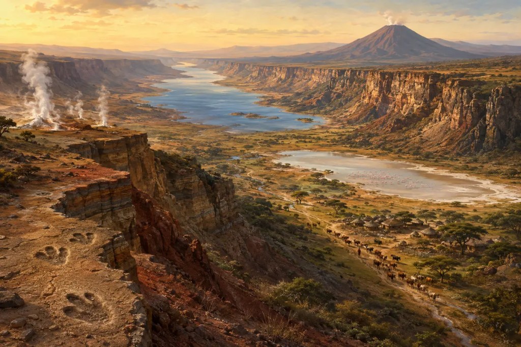
The East African Rift is a wound in a continent that is still opening. Across roughly 3,000 kilometers, the crust has stretched, fractured, and dropped into long valleys bordered by steep escarpments. Volcanoes, deep lakes, hot springs, fertile highlands, and dry basins formed along this zone. These features did more than reshape the land: they influenced ecosystems, preserved evidence of human evolution, directed settlement and movement, and created both hazards and energy opportunities for modern societies.
1. A Continent Being Pulled Apart
The rift begins near the Afar region, where the Red Sea, Gulf of Aden, and East African rift zones meet. Farther south, it divides into eastern and western branches that pass through or beside Ethiopia, Kenya, Tanzania, Uganda, Rwanda, Burundi, the Democratic Republic of the Congo, Malawi, and Mozambique.
Here, forces within Earth stretch the continental lithosphere. Fault-bounded blocks sink while neighboring shoulders rise, and magma reaches upward through weakened crust. The process unfolds over millions of years, but earthquakes, eruptions, and visible ground fractures show that it remains active.
2. Valleys, Volcanoes, and Deep Lakes
Rifting created a dramatic sequence of escarpments, volcanic cones, calderas, plateaus, and elongated basins. Some depressions filled with water. The western branch contains exceptionally deep freshwater lakes such as Tanganyika and Malawi, while the eastern branch includes many shallow, saline, or alkaline lakes.
These waters behave differently because geology controls their depth, drainage, chemistry, and connection to rivers. Closed basins lose water mainly through evaporation, concentrating dissolved minerals. This produces soda lakes whose microscopic life supports immense gatherings of flamingos and other birds.
3. Geography Made a Mosaic of Environments
Over short distances, the rift passes from hot lowlands to cool highlands and from dry grassland to forest and wetland. Escarpments redirect winds and rainfall, while volcanic soils can become highly productive where moisture is sufficient. Lakes supply fish, water, transport, and seasonal refuges for people and wildlife.
Yet the same landscape can be severe. Rainfall varies, drought returns, alkaline water may be unsuitable for drinking, and steep terrain fragments routes. Communities therefore developed different combinations of farming, herding, fishing, hunting, and exchange suited to local elevation and water.
4. A Landscape That Preserved Human History
East African rift basins contain some of the world’s most important evidence for human evolution. Sites around Lake Turkana, the Lower Omo Valley, Olduvai Gorge, Laetoli, and other localities have yielded hominin fossils, animal remains, footprints, and stone tools spanning millions of years.
The rift did not simply “create” humanity. Its faulting, volcanism, erosion, and sediment-filled basins repeatedly buried and later exposed traces of past life. Volcanic ash also provides layers that scientists can date, helping reconstruct when different species and technologies appeared in changing environments.
5. Settlement Around Water and Fertile Ground
People concentrated where the rift offered reliable water, grazing, cultivable soils, fish, or defensible high ground. Ethiopian and Kenyan highlands supported dense farming populations, while pastoral societies moved livestock through grasslands according to rain and pasture.
Lake shores became centers of fishing and exchange, but fluctuating water levels could move coastlines and disrupt livelihoods. The geography rewarded flexibility: households and communities often combined several forms of subsistence rather than depending on a single resource.
6. Corridors, Barriers, and Cultural Exchange
Long valleys could guide movement north and south, while escarpments and volcanic massifs obstructed travel across them. Passes, lake ports, and highland routes therefore gained strategic value. Cattle, ironworking traditions, crops, languages, and religious ideas moved through networks shaped by this uneven terrain.
Modern roads, railways, cities, and borders inherited many of these geographical constraints. Nairobi grew near the eastern branch, Addis Ababa stands beside the Ethiopian rift system, and a chain of towns now links agricultural highlands, wildlife landscapes, lake basins, and international markets.
7. Heat, Hazards, and the Modern Rift
Active geology brings earthquakes, volcanic eruptions, landslides, ground deformation, and dangerous gases. Rapid population growth around cities, farms, and lakes increases exposure, making monitoring and resilient construction increasingly important.
The rift also brings heat close enough to the surface for geothermal development. Kenya has become a leading African producer of geothermal electricity, and exploration continues elsewhere along the system. The same tectonic energy that fractures the land can provide steady, low-carbon power.
Conclusion
The East African Rift reveals civilization living inside an unfinished geological process. Its faults built lakes and highlands, its sediments preserved human ancestry, and its environmental contrasts encouraged adaptation and exchange. Today the rift remains both a source of risk and a reservoir of possibility—a place where the deep movement of Earth still shapes human life.


Leave a Reply