
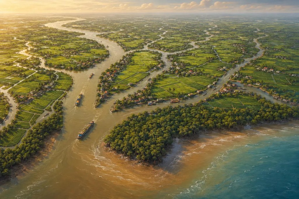
At the southern end of mainland Southeast Asia, the Mekong divides into a maze of distributaries, canals, floodplains, and coastal wetlands before reaching the sea. This low, water-shaped landscape became one of Asia’s great rice-growing regions and a crossroads of river trade. Yet the same processes that made the delta fertile—seasonal floods, moving sediment, and the meeting of fresh and salt water—also make it unusually sensitive to decisions taken far upstream and to changes in the climate and coast.
1. A Plain Built by Moving Water
The Mekong begins far to the north and travels through a vast basin before entering Cambodia and southern Viet Nam. Near the coast, its current slows and separates into multiple channels. Sand, silt, clay, and organic matter carried downstream settle across the plain or are delivered to its shores. Over long periods, repeated deposition built a broad delta only slightly above sea level.
This is not a finished landform. River channels migrate, banks erode, mudflats appear, and tides redistribute sediment along the coast. The delta’s shape has always depended on a balance: the river must deliver enough water and sediment to offset compaction, waves, tides, and erosion.
2. The Flood Pulse as an Ecological Clock
The southwest monsoon produces a strong wet season across the Lower Mekong Basin. Rising water spreads beyond the main channels, fills wetlands, and connects rivers with floodplains. The Mekong River Commission describes this annual flood pulse as a driver of fisheries, river form, and the deposition of fertile sediment.
Flooding can destroy homes and crops when it becomes extreme, but ordinary seasonal inundation is not simply a disaster. It replenishes soil moisture and nutrients, supports aquatic habitats, and brings fish into fields and canals. Delta societies therefore learned to distinguish damaging floods from the useful rhythm of high and low water.
3. Rice, Orchards, and Life Along the Channels
Flat terrain, abundant water, and alluvial soils made wet-rice cultivation the foundation of the delta’s rural economy. Farmers adapted planting calendars to rainfall, river levels, and tides. Dikes, sluices, pumps, and canals later allowed closer control of water and, in many places, more intensive cropping.
The landscape supports more than rice. Fruit orchards occupy natural levees and raised ground; freshwater and brackish-water aquaculture flourish in different zones; mangroves protect parts of the coast and provide nursery habitat. Homes, markets, and workshops historically faced waterways because the canal was often both road and source of livelihood.
4. Canals Turned Geography into Commerce
The delta’s dense water network reduced the cost of moving bulky goods across a wet landscape. Boats carried rice, fruit, fish, timber, ceramics, and people between villages, market towns, ports, and the wider South China Sea. Floating and riverside markets emerged where channels converged.
Canals were not merely transport routes. They drained fields, supplied irrigation, marked settlement lines, and made state administration possible. Successive Vietnamese governments expanded canal systems, while French colonial rule further reorganized waterways and rice exports. Hydraulic engineering increased production, but it also redistributed access to land and water.
5. A Cultural Borderland
The Mekong Delta was shaped by movement as much as by sediment. Khmer communities have deep historical roots in the region; Vietnamese settlement expanded southward over centuries; Chinese trading communities connected towns to maritime commerce; and Cham and other groups contributed to the delta’s cultural mosaic.
Temples, pagodas, churches, mosques, food traditions, and festivals reflect this layered history. The watery environment encouraged local identities that cross rigid administrative boundaries: people living along the same river system often shared trading practices and ecological knowledge even when they spoke different languages or belonged to different states.
6. From Regional Granary to Global Food System
Modern transport, irrigation, crop breeding, and export infrastructure transformed the delta into Viet Nam’s principal rice bowl and a major center of aquaculture and fruit production. According to the Food and Agriculture Organization, the region produces more than half of the country’s grain and links roughly 1.5 million rice farmers to its value chain.
This productivity gives the delta national and international importance. Changes in harvests affect rural incomes, food prices, export earnings, and supply chains far beyond southern Viet Nam. At the same time, dependence on intensive farming has created pressure to reduce chemical inputs, greenhouse-gas emissions, and ecological damage while maintaining livelihoods.
7. A Delta Under Pressure
The Mekong Delta now faces several interacting threats. Upstream reservoirs and sand extraction can alter flows and reduce the sediment available to renew floodplains and coasts. Dikes and channel engineering change where floodwater can spread. Groundwater extraction contributes to land subsidence, while rising seas increase the relative height of coastal water.
During dry periods, weaker freshwater flow allows salt water to move farther inland through rivers and canals. Salinity can damage rice and freshwater orchards, constrain drinking-water supplies, and force farmers to change crops or production systems. Coastal erosion and the loss of mangroves remove further protection from waves and storms.
Conclusion
The Mekong Delta became prosperous not because people eliminated water’s variability, but because they learned to work within it. Its future may depend on recovering that principle at a larger scale: allowing useful floods where possible, conserving sediment and groundwater, matching crops to fresh or brackish conditions, protecting mangroves, and coordinating choices across the river basin. The delta is both a product of nature and a human water system; sustaining it requires treating those two histories as one.


Leave a Reply