
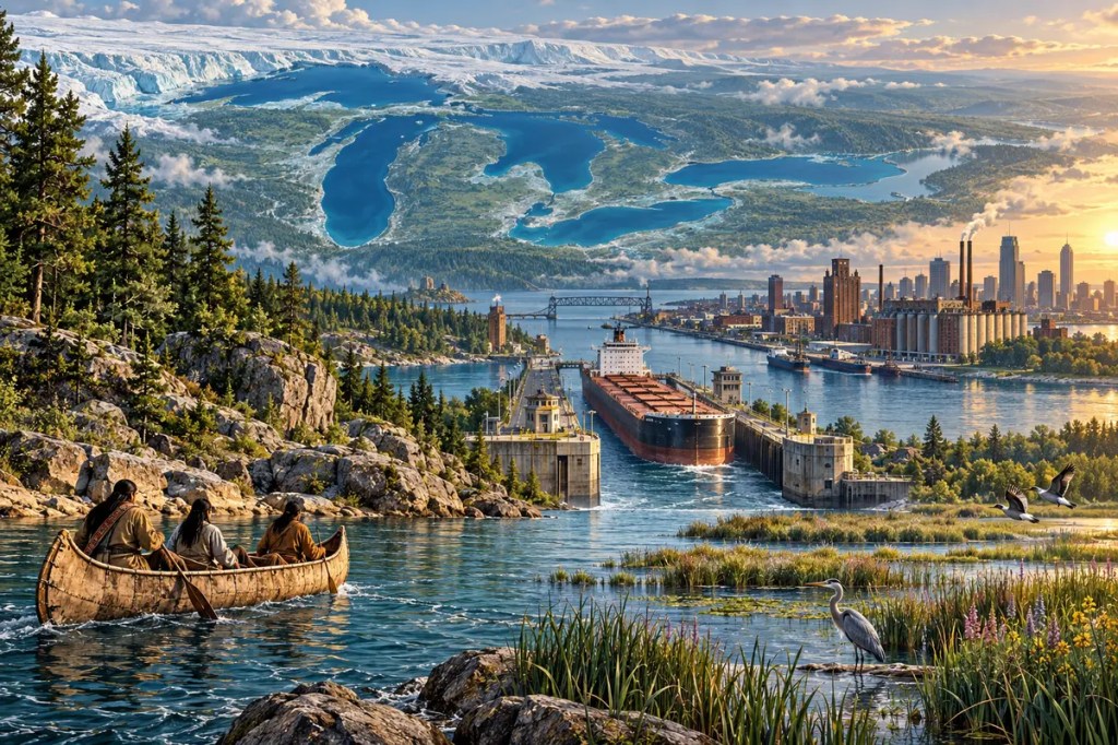
At the heart of North America lies a freshwater system vast enough to behave like a chain of inland seas. Superior, Michigan, Huron, Erie, and Ontario hold about one-fifth of the world’s surface fresh water. Their coastlines, currents, storms, and connecting rivers did more than fill a map: they organized ecosystems, Indigenous homelands, migration routes, industrial cities, international borders, and one of the continent’s most important transportation corridors.
1. Ice Built the Inland Seas
The Great Lakes occupy ancient basins, but their modern form is largely the work of repeated continental glaciation. Enormous ice sheets advanced across the region, following and deepening older valleys while grinding rock, moving sediment, and reshaping drainage. When the last ice retreated, meltwater gathered in the excavated depressions. Shorelines and outlets shifted repeatedly before the five familiar lakes and their connecting channels emerged.
This glacial inheritance explains the system’s scale and variety. Lake Superior is deep, cold, and voluminous; Lake Erie is much shallower and responds more quickly to heat and nutrient inputs. The lakes descend eastward through the St. Marys River, the Straits of Mackinac, the St. Clair–Detroit system, the Niagara River, and finally the St. Lawrence River to the Atlantic. Niagara Falls is both a spectacular landscape and a natural interruption in that watery staircase.
2. A Freshwater Climate Engine
Water changes temperature more slowly than land. The Great Lakes therefore moderate nearby seasons, cooling some coastal areas in spring and summer and delaying the arrival of severe autumn cold. Orchards and vineyards flourish in favored belts along Lakes Erie, Michigan, and Ontario because the water reduces temperature extremes and can postpone spring growth until damaging frosts are less likely.
The same stored heat can intensify winter weather. Cold air crossing relatively warmer open water absorbs moisture and releases it as heavy lake-effect snow on downwind shores. Winds can also build dangerous waves across hundreds of kilometers of open water. These are lakes in chemistry but inland seas in human experience: they create local climates, seasonal hazards, and distinctive ways of living along their coasts.
3. Homelands Connected by Water
Long before modern borders, the lakes and their rivers were homelands and highways for Indigenous nations, including Anishinaabe, Haudenosaunee, Wendat, and many others. Canoe routes joined fishing grounds, villages, seasonal gathering places, and trading networks. Water made movement across a forested continent faster than overland travel, while portages linked one drainage basin to another.
The lakes supplied fish, reeds, waterfowl, fertile shore environments, and access to resources such as the copper of the Lake Superior region. Knowledge of currents, weather, narrows, and seasonal ice was essential infrastructure carried in memory and practice. European explorers and traders later entered an already inhabited and interconnected water world, often relying on Indigenous routes and expertise to move through it.
4. Canals Rewired a Continent
The lakes offered enormous mobility, but geography placed barriers between their waters and the ocean. The Erie Canal, opened in 1825, connected the Hudson River system with Lake Erie and transformed the cost and direction of trade. Grain, timber, manufactured goods, and people could move between the continental interior and New York’s Atlantic port. Communities including Buffalo, Rochester, and Syracuse grew rapidly along the new corridor.
Other engineering works completed the network. The Welland Canal bypassed Niagara Falls, while locks and channels around the rapids of the St. Marys and St. Lawrence rivers joined different lake levels. Geography had created a sequence of freshwater basins; engineering turned that sequence into a continuous commercial system. In doing so, it redirected settlement, strengthened east–west trade, and helped shift the economic center of North America toward the lakes.
5. The Industrial Crescent
Bulk cargo favored water. Iron ore from the Lake Superior region could travel by specialized lake freighters toward steel centers, while coal, limestone, grain, and manufactured products moved in other directions. Ports such as Duluth, Chicago, Detroit, Cleveland, Buffalo, Hamilton, and Toronto became nodes in a manufacturing and transportation belt. Factories clustered where ships, railways, workers, raw materials, and freshwater met.
The opening of the deep-draft St. Lawrence Seaway in 1959 connected the lakes more directly to ocean shipping. The official system extends roughly 3,700 kilometers from the Atlantic to Duluth and uses a sequence of locks and maintained channels. Although railways, highways, and pipelines now share the freight burden, Great Lakes shipping remains particularly efficient for heavy commodities that would be costly to move over land.
6. One Basin, Two Countries
Four of the five lakes form part of the boundary between Canada and the United States; Lake Michigan lies entirely within the United States, but its water belongs to the same connected system. Pollution, water withdrawals, invasive species, shipping rules, and fluctuating lake levels cannot be managed by one jurisdiction alone. The basin has therefore encouraged an unusual tradition of cross-border institutions and agreements.
The 1909 Boundary Waters Treaty created the International Joint Commission to help the two countries prevent and resolve disputes. Later cooperation, including the Great Lakes Water Quality Agreement, treated the lakes increasingly as a shared ecosystem rather than a set of separate political waters. The arrangement is imperfect, but it reflects a geographical fact: currents cross borders without presenting passports.
7. The Ecological Cost of Connection
The same routes that carried prosperity also carried pollution and invasive organisms. Industrial waste and contaminated sediments accumulated near major ports. Canals and ship ballast opened pathways for sea lamprey, zebra and quagga mussels, round goby, and other non-native species. The U.S. Environmental Protection Agency reports more than 180 established aquatic non-native species in the basin, with roughly one-third considered invasive.
Nutrient runoff presents another challenge, especially in shallow western Lake Erie. Excess phosphorus can feed harmful algal blooms and contribute to oxygen depletion. Restoration programs have improved many damaged areas, yet climate change adds new uncertainty through warmer water, changing ice cover, stronger precipitation extremes, and volatile lake levels. Connectivity makes the system economically powerful, but it also allows ecological harm to spread.
8. Conclusion: A Freshwater Civilization
The Great Lakes are not simply five bodies of water beside North American cities. They are a glacial machine that created climate, a network that carried cultures and commerce, a foundation for industrial power, and a shared inheritance that refuses to fit within national borders. The civilization built around them now faces its defining task: keeping an inland sea both useful and alive.


Leave a Reply