
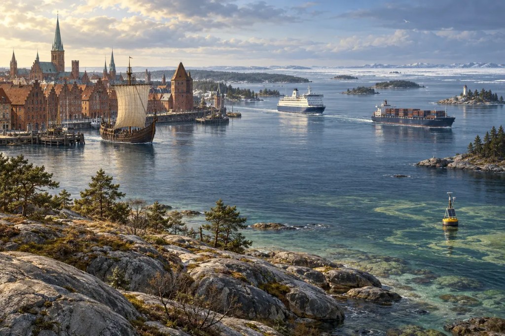
The Baltic Sea looks open on a map, yet it behaves almost like an inland water body. Narrow Danish straits connect it to the North Sea, while rivers drain an enormous surrounding basin into its shallow waters. That geography created a sea of unusual salinity, seasonal ice, crowded ports, and vulnerable ecosystems—and made the Baltic both a bridge between societies and a space that no single country can manage alone.
1. A Sea Left by Ice
The Baltic basin is a legacy of the last Ice Age. Thick ice sheets pressed down on northern Europe, scoured bedrock, deepened hollows, and carried vast quantities of sediment. As the ice retreated, meltwater, changing sea levels, and the gradual rebound of the land repeatedly altered the basin’s connection to the ocean.
This glacial history remains visible in the geography of the region. Sweden and Finland have archipelagos of polished rock and thousands of islands; low sedimentary coasts frame parts of Poland, Germany, and the Baltic states; and land uplift still changes shorelines in the north. The result is not one simple bowl but a chain of basins, gulfs, sounds, and sills with different depths and rates of water exchange.
2. Brackish Water and Fragile Life
Freshwater enters from a drainage basin far larger than the sea itself, while salt water can arrive only through the narrow and relatively shallow Danish passages. The Baltic is therefore brackish: saltier than a lake but much fresher than the open Atlantic. Salinity generally declines from the Danish straits toward the Gulf of Bothnia and Gulf of Finland.
This gradient creates an ecological borderland. Marine species approach the limits of their tolerance as salinity falls, while freshwater species face the opposite challenge. The number of species is comparatively limited, and many live under physiological stress. Because deeper, saltier water can remain separated from fresher surface water, oxygen is not easily replenished on the seabed—especially when nutrient-fuelled algal growth later decomposes and consumes it.
3. Shores, Islands, and Seasonal Ice
The Baltic’s broken coastline created sheltered anchorages, natural harbours, and short maritime stages between islands and capes. In many places, boats could move people and goods more efficiently than carts crossing forests, wetlands, and poorly developed roads. Coastal settlement grew around places where inland river routes met navigable water.
Winter added another rhythm. Northern gulfs can freeze extensively, historically slowing or suspending navigation while also creating temporary routes across ice. Seasonal changes shaped fishing, ship design, storage, and the timing of commerce. Communities learned to treat the sea not as a constant surface but as a landscape that changed character through the year.
4. A Northern Water Road
Long before modern states formed, the Baltic connected Scandinavian, Finnic, Baltic, Slavic, and German-speaking communities. Rivers running toward the sea linked coastal exchange to inland forests, farms, and mineral regions. Amber, wax, furs, timber, iron, grain, salt, cloth, and crafted goods moved through overlapping networks rather than along a single route.
The sea carried raiders and armies, but its deeper historical role was connective. Maritime knowledge made distance manageable, and ports became places where languages, legal customs, technologies, and beliefs met. Control of islands, river mouths, and narrow passages mattered because geography concentrated movement into recognizable corridors.
5. The Hanseatic Web
From the Middle Ages, merchant towns around the Baltic and North seas formed the commercial network remembered as the Hanseatic League. Lübeck became a principal centre linking northern European markets, while cities such as Visby, Riga, Tallinn, Gdańsk, and others served as nodes in a system of privileges, warehouses, councils, and convoy arrangements.
The Hanseatic world did not erase political rivalry, but it showed how maritime geography could produce an urban order that crossed kingdoms. Grain and timber from the east, fish from northern waters, salt and cloth from the west, and many other goods circulated through port cities whose architecture and civic institutions reflected the wealth of trade. The Baltic helped make towns—not only courts and landed estates—central actors in northern European history.
6. Gateways, Empires, and Borders
Because the Baltic has few exits, its entrances carry exceptional strategic weight. The Danish straits connect the sea to the Kattegat and North Sea, turning narrow waters into both trade gateways and potential points of control. States that held coastlines, islands, and naval bases could influence customs revenue, military movement, and access to wider oceans.
Denmark, Sweden, Poland–Lithuania, Russia, Prussia, and other powers competed across the region in different periods. St Petersburg’s foundation on the Gulf of Finland gave the Russian Empire a major Baltic window, while shifting borders repeatedly changed the political identity of ports and hinterlands. In the twentieth century, war and ideological division hardened the sea’s boundaries; after the Cold War, regional integration expanded, even as security tensions later returned.
7. Modern Ports and Regional Dependence
Today the Baltic supports dense networks of ferries, container traffic, bulk shipping, fishing, tourism, offshore energy, pipelines, and data and power cables. Ports connect inland industries to global markets, while short-sea shipping ties cities that may be far apart by road. The same enclosed geography that once favoured merchant leagues now concentrates modern infrastructure.
Concentration also produces risk. Heavy traffic passes through confined waters, oil or chemical accidents can affect several countries, and damage to underwater infrastructure can disrupt energy and communications. Economic efficiency therefore depends on shared navigation standards, hydrographic knowledge, emergency preparedness, and political cooperation across borders.
8. The Sea as a Shared Responsibility
The Baltic’s environmental problems reveal the cost of an interconnected drainage basin. Nutrients from agriculture, wastewater, and other sources encourage eutrophication and algal blooms. When organic material sinks and decomposes, oxygen can be depleted in deeper waters. Hazardous substances, marine litter, fishing pressure, invasive species, and climate change add further stress to an already unusual ecosystem.
Yet the Baltic has also become a laboratory for regional environmental governance. The Helsinki Convention and HELCOM bring coastal states and the European Union into a common framework for monitoring and action, while the EU Strategy for the Baltic Sea Region coordinates work across policy areas. Progress is difficult because water moves across borders and ecological recovery is slow, but that is precisely the lesson of the sea: shared geography creates shared consequences.
The Baltic Sea shaped civilization by turning a glacial basin into a northern highway, a chain of trading cities, a contested strategic space, and a modern infrastructure corridor. Its future now depends on whether the societies joined by its waters can accept the same truth that geography has always imposed: the Baltic may be divided by borders, but it functions as one connected sea.
 Intellesia
Leave a comment