
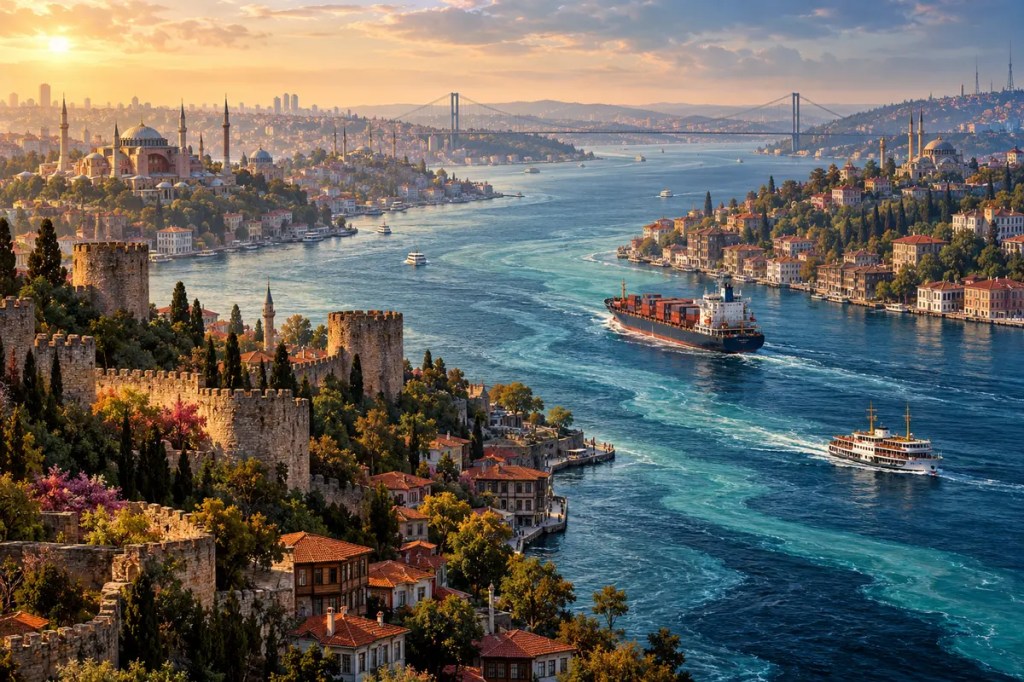
The Bosporus is far more than the waterway that divides Istanbul between Europe and Asia. It is a narrow, winding threshold where the Black Sea meets the Mediterranean world, where surface and deep waters move in opposite directions, and where ships pass through the centre of a great city. For thousands of years, this compressed geography has turned control of a few kilometres of water into commercial opportunity, imperial power, cultural exchange, and international responsibility.
1. A Strait Between Seas
The Bosporus, also called the Istanbul Strait, runs for roughly thirty kilometres between the Black Sea and the Sea of Marmara. From the Marmara, the wider Turkish Straits system continues through the Dardanelles to the Aegean and Mediterranean. The channel is narrow, irregular, and sharply curved, with headlands and bays that often hide approaching vessels from one another.
This is therefore not an open maritime corridor but a constrained one. Currents, bends, changing visibility, dense urban shores, and traffic moving in both directions make navigation demanding. Yet the same narrowness gives the strait enormous leverage: every sea route between the Black Sea and the Mediterranean must pass through this linked system.
2. Two Currents in One Channel
The Bosporus carries a remarkable two-layer exchange. At the surface, relatively fresh Black Sea water generally flows south toward the Marmara. Beneath it, denser and saltier water of Mediterranean origin moves northward. The two currents do not form perfectly separate pipes: bends, sills, winds, and seasonal changes create turbulence and mixing along the passage.
This exchange helps regulate the water, salt, heat, and oxygen balances of connected seas. It also makes the strait a biological corridor for fish and other marine life while imposing strong environmental gradients. Geography here operates in three dimensions. What appears on a map as one blue line is actually a stacked and dynamic system.
3. From Valley to Marine Gateway
The modern Bosporus developed from a landscape repeatedly altered by tectonics, river erosion, and large changes in sea level during the Quaternary period. Geological studies describe a pre-existing valley system that was deepened and reshaped before rising post-glacial seas established the present marine connection. Sediments beneath and beyond the strait preserve evidence of changing directions and strengths of flow.
Scholars continue to debate the exact timing and speed of the final reconnection between the Black Sea and the Mediterranean system. The evidence does not require a single simple story of a sudden catastrophic flood. What is clear is that changing water levels converted a valley into a gateway, reorganising shorelines, currents, habitats, and the possibilities for human movement around the Black Sea.
4. Byzantium, Constantinople, and the Golden Horn
Human settlement benefited from the meeting of land and water routes. Ancient Byzantium occupied a defensible peninsula beside the Golden Horn, a deep natural harbour opening near the southern entrance of the Bosporus. Ships could shelter, repair, trade, and wait for favourable conditions while the city watched movement between the Black Sea and the Mediterranean.
When Constantine made the city an imperial capital in the fourth century, this geography became the foundation of Constantinople’s reach. The city stood between the Balkans and Anatolia and between two maritime worlds. Fortifications protected its landward side, while harbours, customs, granaries, and naval power translated the strait into supplies, revenue, and political endurance.
5. An Ottoman Waterfront World
After the Ottoman conquest of Constantinople in 1453, the Bosporus remained the central water axis of an imperial capital. Fortresses on the European and Anatolian shores demonstrated how command of the narrow channel could support military strategy. Arsenals, docks, markets, and neighbourhoods gathered around the Golden Horn and the southern strait.
The shores also developed a distinctive everyday culture. Fishing villages, ferry landings, gardens, palaces, mosques, and timber waterfront houses known as yalı formed a long inhabited edge. Rather than separating two continents absolutely, the water connected communities through boats. The Bosporus became a street made of water, carrying workers, food, news, and ceremony across the city.
6. The Gate of Black Sea Commerce
Control of the Bosporus influenced the movement of grain, timber, fish, metals, and later industrial goods between Black Sea ports and Mediterranean markets. Merchant communities prospered from provisioning ships, collecting customs, and connecting inland production to maritime trade. Powers around the Black Sea could expand their commerce only by negotiating passage through a strait controlled from Istanbul.
This dependence repeatedly turned the waterway into an object of diplomacy and rivalry. Russian access to warm-water routes, Ottoman security, European commercial interests, and the ambitions of other states all converged here. The Bosporus demonstrates how a physical bottleneck can project local sovereignty into a much larger region.
7. A Strait Governed by Treaty
The modern legal framework rests on the Montreux Convention, signed on 20 July 1936. It affirmed Türkiye’s authority over the Turkish Straits while maintaining freedom of passage for merchant vessels and establishing detailed rules for warships. Those rules vary according to factors such as vessel type, tonnage, notification, whether a state borders the Black Sea, and whether war is under way.
The convention makes geography part of international law. The Bosporus is sovereign territory and an indispensable international passage at the same time. Its regime attempts to balance commercial movement, Turkish security, and the security of Black Sea states—interests that cannot be separated because the channel itself cannot be bypassed by ordinary seaborne traffic.
8. A Megacity Around a Global Passage
Today bridges, rail and road tunnels, ferries, and pipelines bind Istanbul across the Bosporus, while international shipping continues along it. The strait’s bends and currents place large commercial vessels close to historic neighbourhoods and densely populated shores. Türkiye operates vessel-traffic, pilotage, rescue, and navigation services to reduce risks to life, property, cultural heritage, and the marine environment.
Urban runoff, wastewater, shoreline construction, underwater noise, invasive species, and the ecological condition of the Marmara and Black seas all affect the narrow corridor. An accident or pollution event would not remain merely local, just as disruption to passage would be felt far beyond Istanbul. Modern engineering has made crossing easier, but it has not reduced the Bosporus’s strategic or environmental sensitivity.
The Bosporus shaped civilization by concentrating movement into a living, inhabited threshold. It shows how a narrow piece of water can become at once an ecosystem, an urban avenue, an imperial prize, and a legal responsibility shared with the wider world.


Leave a comment