
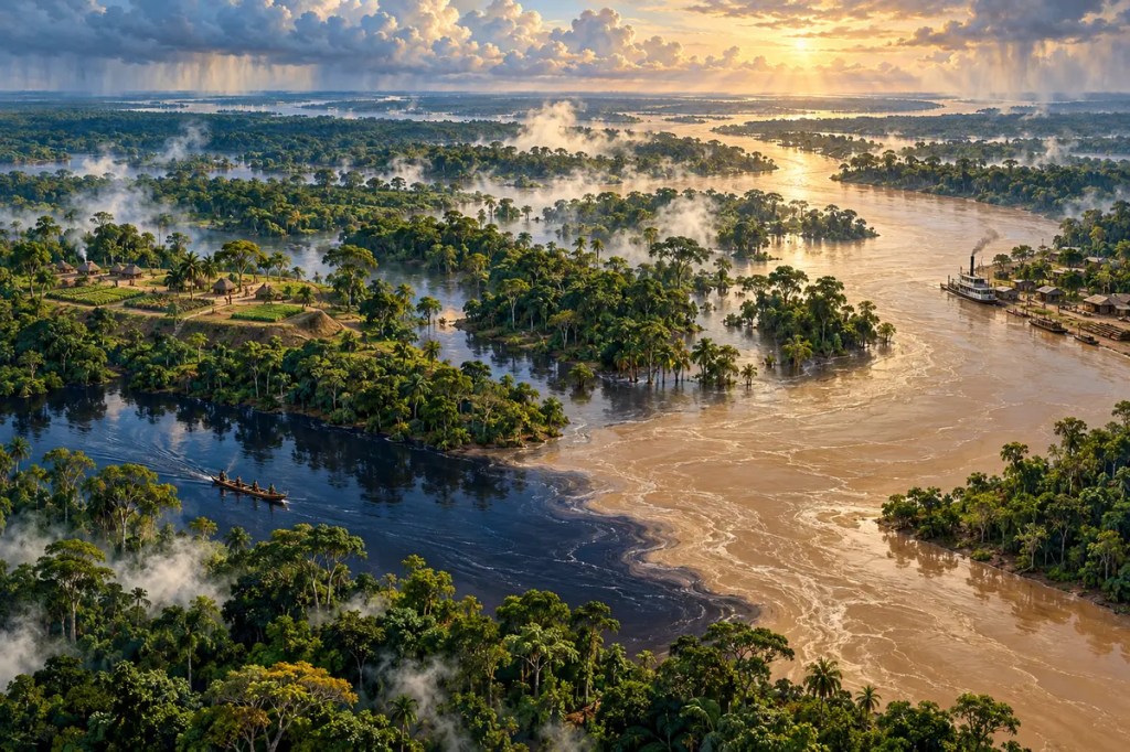
The Amazon Basin is often imagined as an immense forest interrupted by a single great river. In reality, it is a continental water system: thousands of rivers, floodplains, wetlands, forests, and human landscapes joined by rain. Water falling on the Andes and across the lowlands moves through channels, trees, soils, and the atmosphere before reaching the Atlantic. This circulation created extraordinary biological diversity, shaped distinct forms of settlement and exchange, and now links local land-use decisions to the climate of an entire continent.
1. A Basin on a Continental Scale
The Amazon Basin covers a vast part of northern South America and extends across several countries. Its western headwaters descend from the Andes, while tributaries spread across broad lowlands before gathering into the Amazon and flowing east to the Atlantic. Measured by the volume of water it carries, no other river system is comparable.
The basin is not physically uniform. Mountain streams carry sediment from young Andean slopes; ancient uplands contribute clearer or darker waters; low gradients allow rivers to meander, split, reconnect, and occupy enormous seasonal floodplains. This variety produces a network in which distance is measured not only across land but along moving water.
2. The Forest That Helps Make Rain
Moisture arrives from the tropical Atlantic, falls as rain, and is returned to the atmosphere through evaporation and transpiration from vegetation. Forests therefore do more than receive the regional climate: they participate in it. Recycled moisture helps sustain further rainfall across the basin and can be carried beyond it by atmospheric flows sometimes described as “flying rivers.”
This cycle connects forest cover, soil moisture, clouds, and river discharge. Seasonal changes determine when floodplains fill, when fish migrate, when crops can be planted, and when boats can reach smaller channels. A disruption in one part of the system can travel through water or air to places far away, making the basin a network of consequences rather than a collection of isolated landscapes.
3. Flooded Forests and Many Kinds of Water
Amazonian rivers differ in colour, chemistry, sediment, and the landscapes they drain. Sediment-rich whitewater rivers descending from the Andes can renew fertile floodplain soils. Blackwater rivers are stained by dissolved organic matter and often carry fewer suspended sediments, while clearwater rivers drain other geological regions. Where these waters meet, their contrasting colours may remain visible before gradually mixing.
Seasonal flooding creates forests, lakes, islands, channels, and wetlands that expand and contract through the year. Plants and animals are adapted to this pulse. Fish move into flooded forest to feed and disperse seeds; communities time fishing, travel, and cultivation to changing water levels. The flood is therefore not simply a disaster. In many places it is the organising rhythm of life.
4. A Forest Long Shaped by People
The old image of a completely untouched forest inhabited only by scattered groups has been revised by archaeology. Researchers have documented earthworks, raised fields, roads, settlement networks, managed forests, and areas of fertile Amazonian Dark Earth. These findings show that many Indigenous societies modified particular landscapes intensively while adapting to local soils and seasonal water.
Amazonian peoples cultivated and managed plants including manioc, maize, squash, palms, and fruit trees, often combining fields with forest resources rather than replacing every tree. The scale and density of settlement varied greatly across the basin, and scholars continue to debate regional population estimates. What is no longer persuasive is the idea that human history and forest history can be separated.
5. Rivers as Roads
Dense forest and waterlogged ground made overland movement difficult, but rivers opened long corridors. Canoes connected fishing grounds, gardens, ceremonial centres, and trading partners. Communities often occupied terraces, bluffs, tributary mouths, and confluences where they could reach several environments while remaining above ordinary floods.
European colonisation also followed waterways. Missions, forts, trading posts, and later cities grew at strategic river sites. Manaus rose near the meeting of the Negro and Solimões; Santarém developed where the Tapajós meets the Amazon; Belém guarded access near the estuary. The river network channelled conquest and disease as well as commerce, tying distant settlements to Atlantic markets.
6. Rubber, Extraction, and Unequal Booms
In the nineteenth and early twentieth centuries, global demand for natural rubber transformed parts of the basin. Steam navigation and river ports moved latex, workers, manufactured goods, and capital through the interior. Manaus and Belém acquired theatres, warehouses, utilities, and conspicuous wealth linked to a commodity harvested from forest trees.
The boom was also built on coercion, debt, displacement, and extreme violence against Indigenous communities and labourers. When plantation rubber from Asia undercut Amazonian production, much of the prosperity collapsed. The episode established a recurring pattern: distant markets assigned sudden value to a forest product, infrastructure expanded around extraction, and local societies carried the costs after prices changed.
7. Roads Across a River World
Twentieth-century development policies treated roads as instruments for integrating the forest interior with national economies. Highways encouraged settlement, logging, ranching, mining, and commercial agriculture away from the older river corridors. Deforestation often followed the geometry of access, spreading outward from roads in branching patterns visible from space.
Dams and ports have added new forms of connection while altering fish migration, sediment movement, flood cycles, and community access to land and water. Cattle, soy, minerals, timber, and electricity link the basin to global supply chains. The geography that once constrained movement now interacts with machinery and capital capable of transforming large areas rapidly.
8. A Planetary System with Local Guardians
The Amazon stores carbon, circulates moisture, supports immense biodiversity, and carries freshwater and nutrients to the Atlantic. Deforestation, degradation, drought, and fire can weaken these functions and reinforce one another. Yet the basin is not one political unit. Its rivers and atmospheric moisture cross borders, while land-use authority is divided among countries, states, municipalities, protected areas, and Indigenous territories.
Satellite monitoring, protected-area management, restoration, supply-chain rules, and recognition of Indigenous land rights all contribute to conservation, but none works alone. Communities that have managed forests and rivers over generations hold knowledge essential to any durable response. Protecting the basin means treating it as both a living Earth system and a homeland shaped by long human histories.
The Amazon Basin shaped civilization not by offering an empty wilderness, but by creating a water world in which forests make rain, floods organise life, and rivers become roads. Its future depends on recognising that the basin’s climate, economy, ecology, and cultures are parts of the same connected system.


Leave a comment