
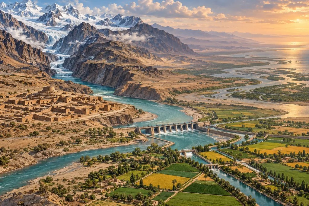
Rising among the highlands and glaciers of inner Asia, the Indus crosses mountain gorges and arid plains before reaching the Arabian Sea. Its seasonal water sustained one of the world’s earliest urban civilizations, became the backbone of an immense irrigation economy, and now binds food security, international politics, and climate risk into a single river system.
1. A River from Ice to Desert
The Indus begins on the high Tibetan Plateau and runs northwest through the cold, elevated landscapes of Ladakh before bending through the great mountain knot of the Karakoram and western Himalaya. In these upper reaches, snowfields, glaciers, steep tributaries, and narrow gorges gather water from terrain where settlements are sparse but the river’s future volume is being assembled.
Farther south, the river enters Pakistan and receives major tributaries connected to the Punjab—the “land of five rivers.” It then follows a long course across increasingly dry plains to the Arabian Sea. This contrast is the Indus system’s essential geography: water collected in high mountains is carried across regions where rainfall alone could not support such dense agriculture and settlement.
2. A Seasonal Pulse of Snow and Monsoon
The Indus is fed by several rhythms at once. Winter snow accumulates in the mountains; spring and summer warmth releases meltwater; glaciers contribute flow from the highest ranges; and the summer monsoon adds highly variable rain, especially across the lower basin and its eastern tributaries. Together these sources create a seasonal pulse that farmers have learned to anticipate but can never fully control.
Floods spread sediment and moisture across the plain, renewing soils while also threatening homes and crops. Drought reverses the danger, shrinking canals and intensifying competition among users. The river therefore shaped a civilization of calendars, embankments, storage, measurement, and collective maintenance—institutions built around the fact that water arrives unevenly in both time and space.
3. Cities of the Indus Civilization
By the third millennium BCE, the Indus valley supported one of the earliest large urban civilizations. Cities such as Mohenjo-daro and Harappa were connected to productive floodplains and wider networks of exchange. Mohenjo-daro’s carefully arranged streets, brick architecture, wells, and drainage reveal a society that made water management part of urban design rather than treating the river as mere scenery.
The Indus did not determine a single way of life, nor does one simple river story explain the civilization’s transformation. Channels shifted, rainfall patterns changed, and settlements reorganized over long periods. What endures is the scale of adaptation: communities converted an unpredictable floodplain into farms, towns, routes, and civic systems while remaining vulnerable to changes in the water landscape beneath them.
4. Canals, Barrages, and a Hydraulic Landscape
Irrigated agriculture in the basin has ancient roots, but the modern system expanded dramatically through networks of barrages, main canals, branch canals, and distributaries. British colonial engineering enlarged and regularized many canal colonies in Punjab; after independence, Pakistan extended this hydraulic infrastructure into the Indus Basin Irrigation System.
The result is an engineered landscape visible from space: geometric fields and settlement lines spreading outward from the river. Barrages divert seasonal flows to wheat, rice, cotton, sugarcane, and other crops across Punjab and Sindh. Leaking canals also recharge groundwater, linking surface water and aquifers so closely that managing one without the other can create salinity, waterlogging, or falling water tables.
5. A River Divided by Borders
The partition of British India in 1947 placed political borders across an irrigation network whose canals and headworks had been designed as an integrated system. Water that crossed the new frontier became an immediate question of sovereignty, security, and survival. Geography had created interdependence; statehood made that interdependence politically charged.
After nine years of negotiations, India and Pakistan signed the Indus Waters Treaty in 1960 with the World Bank’s assistance. The agreement created rules and institutions for sharing the river system and for resolving differences over projects. Its significance lies not only in allocation but in the recognition that infrastructure upstream can shape livelihoods downstream across an international boundary.
6. Food, Power, and Unequal Access
The Indus basin is the agricultural core of Pakistan and supports a vast rural economy. Its canals supply fields, its reservoirs generate electricity, and its flows sustain cities and industries. This productivity turned a naturally dry region into a major food-producing landscape, but it also made national well-being dependent on the upkeep of dams, barrages, canals, drains, and groundwater pumps.
Access is not equal. Farmers near canal heads can receive more reliable water than those at the tail ends; large landholders often have more capacity to drill wells or absorb crop losses; and delta communities bear the consequences when too little freshwater and sediment reach the sea. The river’s benefits and burdens are distributed through power as much as through topography.
7. Flood, Drought, and a Changing Cryosphere
The Indus now faces compound risks. Changes in mountain snow and glaciers can alter the timing and reliability of meltwater, while warmer conditions intensify uncertainty across the headwaters. Farther downstream, extreme monsoon rainfall can overwhelm rivers, reservoirs, canals, and drainage systems, as the catastrophic flooding of 2022 demonstrated.
These dangers do not move in a single direction. A hotter future can bring destructive floods in some years and severe shortages in others. Population growth, groundwater depletion, polluted return flows, and reduced freshwater reaching the delta add pressures that climate alone cannot explain. Resilience therefore depends on both environmental knowledge and fair, capable institutions.
8. The Indus as a Shared Future
The river’s future will be shaped by choices made from glacier valleys to the coast: measuring snow and groundwater more accurately, maintaining canals, improving irrigation efficiency, protecting floodplains and wetlands, restoring flows toward the delta, and keeping cross-border channels of communication open. Each action addresses a different reach of the basin, but none succeeds in isolation.
The Indus has always been more than a line of water. It is a mountain-to-sea system in which ice, sediment, crops, cities, laws, and borders remain connected. To understand the civilization it shaped is to see that engineering can extend a river’s gifts, yet cannot abolish the need to share risk and adapt to change.
Across five thousand years, the Indus has taught the same demanding lesson: societies flourish not by conquering a river, but by learning how to live with its movement, limits, and many claimants.


Leave a comment