
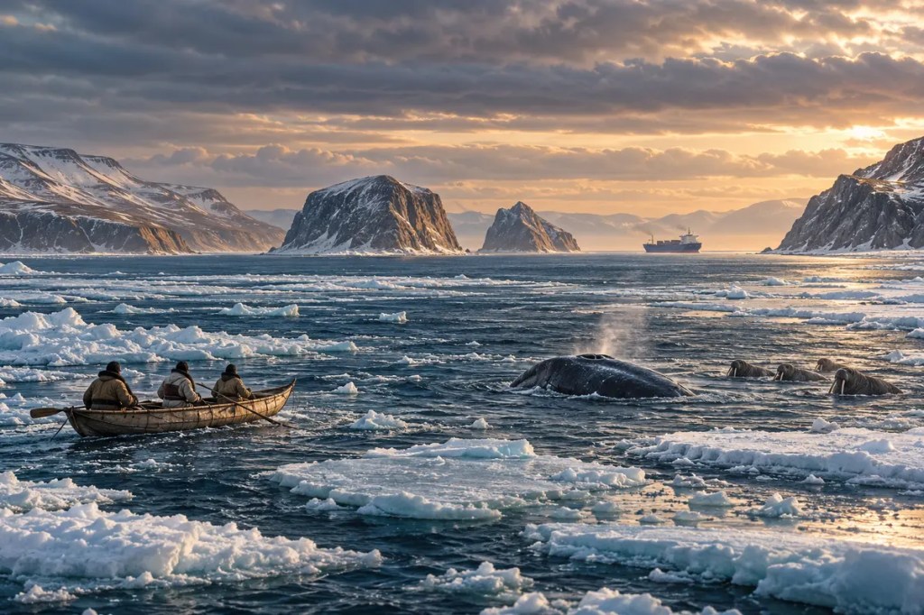
On a map, the Bering Strait looks like a narrow interruption between Alaska and Siberia. In practice, it is one of the planet’s great hinges: a shallow gate between the Pacific and Arctic oceans, a former land bridge between continents, a seasonal corridor for whales and walruses, and a homeland whose human ties long predate the border drawn through its waters.
1. A Narrow Gate Between Continents
The Bering Strait separates the Chukchi Peninsula of Russia from Alaska’s Seward Peninsula and connects the Bering Sea with the Chukchi Sea. At its narrowest, the passage is roughly 85 kilometres wide. The Diomede Islands rise near its centre, turning one channel into two and placing Asia and North America within sight of one another.
Its shallowness matters as much as its width. Much of the strait is only a few dozen metres deep, so small changes in sea level can transform water into land or land into water. Geography made this place a threshold, but climate repeatedly decided what kind of threshold it would be.
2. When the Strait Was Beringia
During the coldest phases of the Pleistocene, vast ice sheets locked up enough water to lower global sea level and expose the continental shelf beneath today’s strait. The result was not a thin bridge but a broad region called Beringia, linking northeastern Asia and northwestern North America across what are now the Bering and Chukchi seas.
Beringia supported a mosaic of grasses, flowering plants, and shrub tundra. Animals moved through this open country, and people also crossed or lived within the wider region. Archaeologists continue to debate the timing and routes of the earliest peopling of the Americas, especially the roles of inland and coastal pathways, but Beringia remains central to the history of movement between the continents. As the climate warmed after the last glacial maximum, rising seas submerged the shelf and created the modern strait.
3. An Oceanographic Chokepoint
Water generally flows northward through the strait from the Pacific into the Arctic. This inflow is seasonally warm, relatively fresh, and rich in nutrients. Because the opening is narrow and shallow, it restricts and concentrates the exchange, making the strait an oceanographic bottleneck whose influence reaches far beyond its immediate shores.
The incoming water helps shape salinity, stratification, sea-ice melt, and biological productivity in the Chukchi Sea and farther into the Arctic Ocean. Winds can briefly reverse or weaken the flow, yet the long-term northward transport remains a fundamental connection between two ocean systems. A passage small enough to cross in hours can therefore alter conditions across an entire basin.
4. A Biological Highway
The same constriction that channels water also funnels life. Bowhead and gray whales, belugas, Pacific walruses, and several seal species move through or depend on the Bering Strait region. Seabirds gather around productive waters and island cliffs, while fish pass between the Bering and Chukchi seas.
These migrations follow the seasonal advance and retreat of sea ice. Ice is not merely an obstacle: it provides resting and breeding habitat, influences access to prey, and marks the shifting edge where sunlight and nutrients can support intense food webs. The strait functions less like a fixed line than a breathing corridor whose width, timing, and abundance change through the year.
5. Homelands Across the Water
The Bering Strait is the homeland and waters of Yup’ik, Iñupiaq, and Siberian Yupik peoples, while Chukchi communities live on the Asian side of the broader region. For generations, boats, sea ice, weather knowledge, and the movements of marine animals have organized travel, hunting, exchange, and community life.
From this perspective, the water did not simply divide two continents. It connected settlements through kinship, trade, language, and shared ecological knowledge. Subsistence harvests of marine mammals and fish are not remnants of an isolated past; they remain living practices tied to food security, identity, and the careful reading of seasonal conditions.
6. A Border Through a Connected Region
The strait’s modern English name recalls the Danish-born navigator Vitus Bering, who sailed for the Russian Empire in the eighteenth century, although Indigenous peoples had known and travelled these waters for millennia. Russian expansion, the United States’ purchase of Alaska in 1867, and later maritime agreements turned the channel into an international boundary.
During the Cold War, that boundary hardened into what became known as the “Ice Curtain.” Big Diomede belonged to the Soviet Union and Little Diomede to the United States, even though only a few kilometres separated them. Political geography restricted movements that physical geography and family histories had long encouraged, revealing how a border can divide a cultural landscape without erasing it.
7. Shipping Through a Constrained Passage
As Arctic sea ice retreats for longer periods, the Bering Strait has gained strategic importance as the Pacific entrance to northern shipping routes. Cargo vessels, research ships, fishing fleets, and local boats must share a passage where storms, fog, ice, limited infrastructure, and long distances complicate navigation and emergency response.
In 2018, the International Maritime Organization adopted six voluntary two-way routes and six precautionary areas proposed jointly by the United States and Russia. The measures seek to reduce collision and grounding risks while protecting the marine environment and local fishing activity. Yet route lines alone cannot resolve every danger: a major spill, underwater noise, or disruption of animal migrations could travel rapidly through ecosystems and communities on both sides.
8. A Strait Under Rapid Change
Climate change is altering the timing, thickness, and persistence of sea ice in the Bering and Chukchi seas. Less predictable ice affects travel safety, coastal exposure to waves, access to hunting grounds, and the seasonal movements of animals. Warmer water and shifting species distributions can redraw the ecological map even while the political border remains fixed.
The future of the strait will depend on cooperation across several scales: local knowledge and community planning, scientific observation, search-and-rescue capacity, shipping rules, and international stewardship. The region’s residents are not simply observers of a new Arctic gateway; they are rights-holders and knowledge-holders whose experience is essential to navigating change.
The Bering Strait shows how a narrow place can hold an immense history. It has been land and sea, bridge and border, habitat and highway—an enduring reminder that geography does not merely separate worlds; it also creates the passages through which worlds meet.
Further reading
- National Park Service — Bering Land Bridge
- National Park Service — Nature and Science in Beringia
- NOAA Fisheries — The Strait Connecting the Pacific and Arctic Oceans
- NOAA — Living Marine Resources of the Hope Basin
- International Maritime Organization — Bering Sea and Strait Routeing Measures
- NOAA Ocean Service — Arctic Navigation


Leave a Reply