
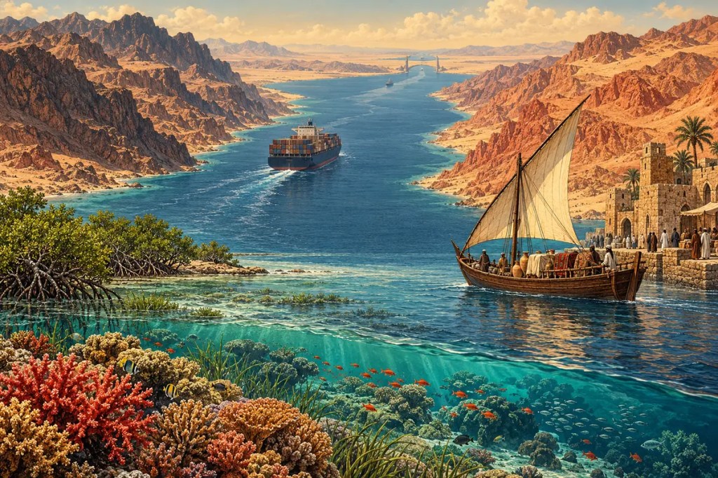
Between the deserts of northeast Africa and Arabia lies a sea that appears narrow on a globe but has repeatedly widened the human world. The Red Sea was opened by separating continents, bordered by some of Earth’s driest landscapes, filled with unusually saline water and coral reefs, and turned by sailors, pilgrims, merchants, and engineers into a passage between the Mediterranean and the Indian Ocean.
1. A Sea Born from Separation
The Red Sea occupies a long tectonic rift between the African and Arabian plates. Crustal extension, faulting, and volcanism began tens of millions of years ago as Arabia pulled away from Africa. By roughly 20 million years ago, seafloor spreading had begun to create new oceanic crust along parts of the basin. The process continues, making the sea a young and still-developing ocean basin.
This origin explains the Red Sea’s steep-sided shape. Mountain escarpments rise close to both coasts, while the central trough descends into deep water. At the north, the Sinai Peninsula divides the sea into the Gulfs of Suez and Aqaba; at the south, the narrow Bab el-Mandeb links it to the Gulf of Aden and the wider Indian Ocean. Tectonics created the basin, but these gateways govern how water, organisms, and ships move through it.
2. Heat, Salt, and Coral
The Red Sea is surrounded by hot, arid land and receives very little river water. Strong evaporation removes freshwater while leaving dissolved salts behind, producing some of the saltiest open seawater on Earth. Exchange through Bab el-Mandeb partly renews the basin, yet the restricted opening and dry climate give the sea a distinctive physical environment.
That environment supports extensive coral reefs, seagrass beds, mangroves, fish, turtles, seabirds, and marine mammals. Sudan’s Sanganeb and Dungonab Bay–Mukkawar Island World Heritage property includes reefs, lagoons, islets, seagrass, and mangrove habitats. Some northern Red Sea corals have also shown unusual resistance to thermal stress, making the region important for research into how reefs may endure a warming climate.
3. A Marine Corridor Beside the Desert
Along much of the coast, mountains and desert limit rain-fed farming and concentrate settlement around wells, oases, wadis, and ports. The sea therefore became more than an edge. It offered fish, salt, pearls, transport, and access to distant markets, while coral reefs and shoals demanded careful local knowledge from sailors.
Seasonal winds and currents shaped when vessels could travel, and the narrowness of the basin kept opposite shores within a connected maritime zone. Communities in Egypt, Sudan, Eritrea, Djibouti, Yemen, and the Arabian Peninsula developed around different combinations of caravan routes, fishing grounds, anchorages, and pilgrimage traffic. Scarcity on land increased the value of movement by sea.
4. Incense, Spices, and Ancient Exchange
For millennia, the Red Sea connected the Nile Valley and Mediterranean world with Arabia, the Horn of Africa, and the Indian Ocean. Frankincense and myrrh from southern Arabia and northeast Africa moved toward Egyptian and Mediterranean consumers, while spices, textiles, precious stones, and other goods arrived through longer maritime networks from South Asia and beyond.
Ports translated between sea routes and desert roads. Cargo unloaded on the coast could cross toward the Nile, continue north by caravan, or be redistributed along Arabia. Under the Ptolemies and Romans, Egyptian Red Sea ports helped sustain commerce with the Indian Ocean. The basin’s geography did not create one continuous empire; it created a chain of exchange in which many ports and peoples depended on one another.
5. Ports, Pilgrims, and Competing Powers
The rise of Islam gave the Red Sea an additional role as a corridor of pilgrimage. Jeddah became a principal maritime gateway to Mecca, receiving travellers from Africa, South Asia, and Southeast Asia. Suakin, Massawa, and other ports joined regional networks carrying people as well as grain, coffee, textiles, ideas, and languages.
Control of these routes attracted states and empires. Egyptian dynasties, Arabian polities, the Ottoman Empire, and European maritime powers all sought influence over ports, islands, and straits. Yet political authority was never the whole story. Merchants, shipbuilders, pilots, fishing communities, and pilgrims turned strategic geography into an everyday human landscape.
6. The Suez Canal Rewrites Distance
The opening of the Suez Canal in 1869 connected the Mediterranean directly to the Red Sea. Ships travelling between Europe and the Indian Ocean no longer had to round the Cape of Good Hope. A sea that had long linked regional routes became the central reach of a global maritime shortcut.
The canal transformed port economies, naval strategy, imperial competition, and Egypt’s political history. It also intensified the environmental connection between the two seas, allowing organisms to migrate through the artificial waterway. Geography had once placed a narrow isthmus between maritime systems; engineering converted that barrier into one of the world’s most consequential passages.
7. A Global Chokepoint Under Pressure
Modern shipping must pass through two constrictions to use the Red Sea route: the Suez Canal in the north and Bab el-Mandeb in the south. This geometry saves distance and fuel when the corridor is open, but it also concentrates risk. Conflict, accidents, blockages, or insecurity in a small area can redirect vessels around Africa and raise transport time, insurance costs, fuel use, and freight rates far beyond the region.
Recent disruption made that dependence visible. UN Trade and Development reported that by May 2025, tonnage through the Suez Canal remained about 70 percent below its 2023 level. On 16 September 2026, the Suez Canal Authority reported that net tonnage of container ships transiting during January–August 2026 had risen 54.2 percent from the same period in 2025. The partial rebound showed both the corridor’s enduring value and the sensitivity of global trade to conditions along the Red Sea.
8. A Living Sea to Be Shared
The Red Sea’s future is not only a question of shipping. Coastal construction, pollution, overuse of marine resources, warming water, and damage from anchoring or dredging can threaten reefs and the livelihoods they support. Its ecosystems cross national boundaries, so monitoring, protected areas, safer navigation, and regional cooperation are as necessary as port and canal infrastructure.
Some Red Sea corals may offer valuable lessons in resilience, but resilience is not immunity. Protecting reefs, mangroves, seagrass beds, fisheries, and coastal communities requires reducing both global climate pressures and local ecological stress. The same narrow geography that concentrates trade also makes environmental harm difficult to contain.
The Red Sea shows how a rift can become a route. Born from separating continents, it drew shores together through ecology, trade, faith, and engineering—an enduring reminder that the most powerful corridors are also living places whose value cannot be measured by ships alone.
Further reading
- USGS — Middle Tertiary Continental Rift and Evolution of the Red Sea
- NOAA — Sea Water and Salinity
- UNESCO — Sanganeb Marine National Park and Dungonab Bay–Mukkawar Island
- Smithsonian — Caravan Kingdoms and the Ancient Incense Trade
- Suez Canal Authority — Canal History
- UN Trade and Development — Maritime Trade Under Pressure


Leave a Reply