
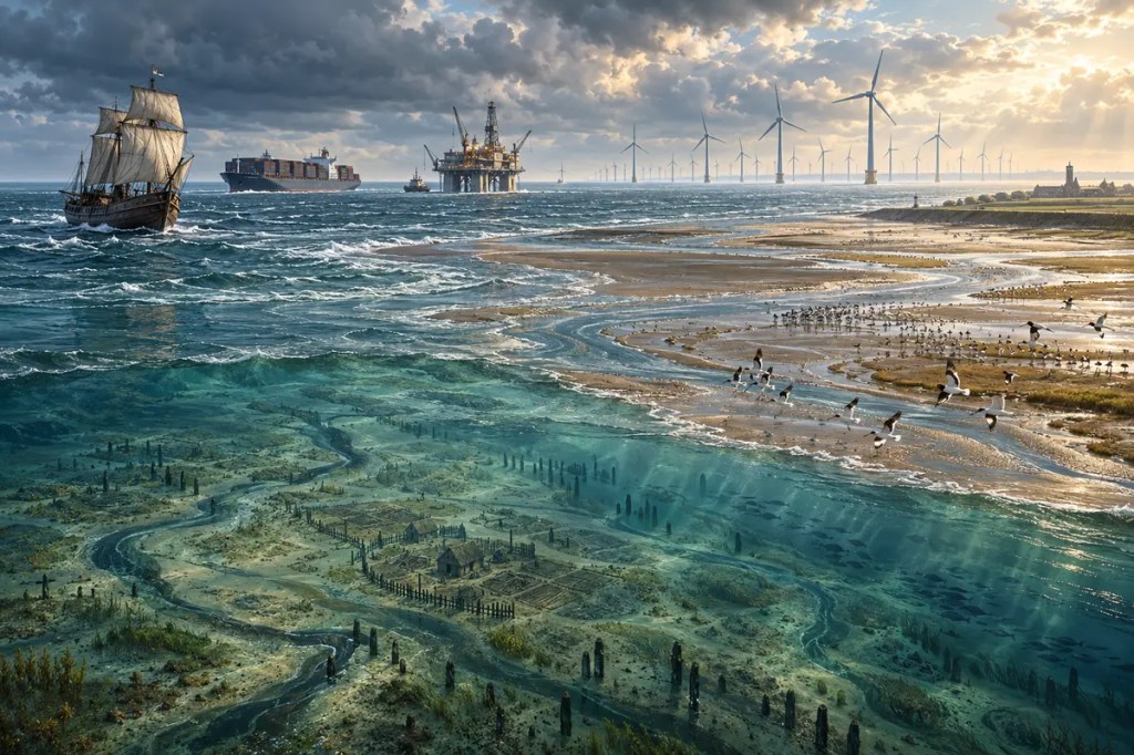
Between Britain, Scandinavia, and the low countries of continental Europe lies a sea that is young, shallow, and densely used. The North Sea was once partly land, then became a stormy shelf sea, a fishing ground, a commercial crossroads, an oil and gas province, and now a testing ground for offshore wind. Few seas show so clearly how changing water can repeatedly reorganize human life.
1. A Sea Made by Ice and Rising Water
The North Sea occupies a broad depression on the continental shelf of north-western Europe. During repeated ice ages, glaciers advanced across parts of the basin, while lower global sea level exposed large areas that are now underwater. Ice, meltwater, rivers, and sediment carved and filled the landscape long before the present coastline existed.
As the last ice age ended, melting ice sheets raised global sea level. Rivers, wetlands, hills, and plains were gradually flooded, creating the modern shelf sea during the Holocene. The North Sea is therefore geologically young: its floor preserves older channels and landforms beneath layers of marine sediment, while its present shores remain active landscapes of dunes, estuaries, cliffs, tidal flats, and reclaimed land.
2. Doggerland, the Drowned Plain
The southern basin once contained a low-lying landscape now commonly called Doggerland. It connected Britain with mainland Europe and supported rivers, lakes, marshes, plants, animals, and hunter-gatherer communities. Archaeologists reconstruct it from seabed mapping, sediment cores, animal bones, and artefacts recovered by fishing and dredging.
Post-glacial sea-level rise did not erase this world in a single moment. It reduced the habitable plain over thousands of years, divided communities, and eventually helped turn Britain into an island around eight thousand years ago. Doggerland makes the North Sea a record of human adaptation as well as geology: beneath modern shipping lanes and energy platforms lies a lost cultural landscape.
3. Shallow Water, Strong Tides, Violent Storms
Much of the North Sea is shallow, although it deepens toward Norway. Atlantic water enters mainly from the north, while exchange also occurs through the English Channel and toward the Baltic through the Skagerrak and Kattegat. Winds, tides, river discharge, and the shape of the basin continually mix and move its water.
Shallowness makes the sea productive, but it also allows wind to build steep waves and drive dangerous storm surges toward low coasts. Communities around the southern and eastern shores responded with dikes, dunes, drainage works, polders, sea walls, and movable barriers. The struggle against flooding helped shape Dutch, German, Danish, Belgian, and British landscapes, institutions, and engineering traditions.
4. Tidal Flats, Fisheries, and Coastal Life
Where the North Sea meets the coasts of the Netherlands, Germany, and Denmark, the Wadden Sea forms an immense system of tidal channels, mudflats, salt marshes, sandbanks, and islands. Twice-daily exposure and flooding create exceptionally productive habitats that support fish, shellfish, seals, and vast numbers of migratory birds.
Beyond the tidal flats, the wider sea has long supported herring, cod, flatfish, shellfish, and other fisheries. Seasonal movements of fish influenced the location and fortunes of ports, curing industries, markets, and coastal communities. Intensive fishing also altered stocks and seabed habitats, making international science and regulation necessary in a sea shared by many states.
5. A Maritime Market Between Shores
The North Sea connected rather than separated its coasts. Viking-age sailors used it for trade, settlement, raiding, and political expansion. In the Middle Ages, merchant towns linked North Sea and Baltic routes, carrying grain, timber, fish, salt, cloth, metals, and other goods through a network associated with the Hanseatic League.
Later, ports such as London, Antwerp, Rotterdam, Hamburg, and smaller regional harbours tied inland rivers and manufacturing districts to oceanic commerce. Estuaries became gateways where ships, warehouses, canals, railways, and factories converged. The sea’s position between Atlantic routes and Europe’s industrial core helped make its shores among the world’s most urbanized and commercially connected.
6. Industry Moves Offshore
In the twentieth century, engineers began treating the seabed itself as an industrial territory. Natural-gas production began in the southern North Sea in the 1960s, and the discovery of Norway’s Ekofisk field in 1969 announced a much larger petroleum era. Production from Ekofisk began in 1971, followed by pipelines, platforms, service ports, and supply chains across the region.
North Sea oil and gas reshaped national revenues, energy security, coastal employment, and engineering expertise, especially in Norway and the United Kingdom. They also brought spills, emissions, seabed disturbance, and the long responsibility of dismantling offshore structures. As mature fields decline, decisions about decommissioning and reuse have become part of the sea’s next transformation.
7. From Petroleum Basin to Power Grid
The same conditions that made offshore work difficult also made the North Sea attractive for wind power: strong winds, broad shallow shelves, nearby electricity markets, and decades of maritime engineering experience. Turbines now occupy growing areas of the sea, while planners consider interconnectors, energy islands, hydrogen production, and coordinated offshore grids.
At the 2023 Ostend summit, nine countries set an ambition of at least 300 gigawatts of North Sea offshore wind capacity by 2050, with an intermediate goal of 120 gigawatts by 2030. Reaching that scale requires cross-border planning, ports and supply chains, resilient cables, and careful choices about fishing grounds, shipping routes, bird migration, marine mammals, and seabed habitats.
8. A Crowded Sea with a Shared Future
The North Sea is now simultaneously an ecosystem, transport corridor, fishing ground, military space, archaeological archive, petroleum province, and renewable-energy zone. Climate change adds another layer: warming water shifts species, while sea-level rise and storm surges increase pressure on low-lying coasts and the tidal habitats in front of them.
No coastal state can manage these changes alone. Pollution, fish, currents, cables, ships, and migrating wildlife cross borders, so monitoring and planning must do the same. The central challenge is not choosing a single use for the sea, but deciding how many essential uses can coexist without destroying the ecological and cultural foundations on which they depend.
The North Sea has never been a fixed boundary. It was land before it was sea, a route before it was an energy field, and a living ecosystem before any map divided it. Its future will depend on whether the societies around it can treat a crowded sea not as empty space, but as a shared and changing world.
Further reading
- Historic England — To Unpath’d Waters, Undream’d Shores
- European Environment Agency — North Sea
- UNESCO — Wadden Sea
- UNESCO — Hanseatic City of Lübeck
- Norwegian Offshore Directorate — Norway’s Petroleum History
- European Commission — North Seas Energy Cooperation
- OSPAR — Human Activities in the North-East Atlantic


Leave a Reply