
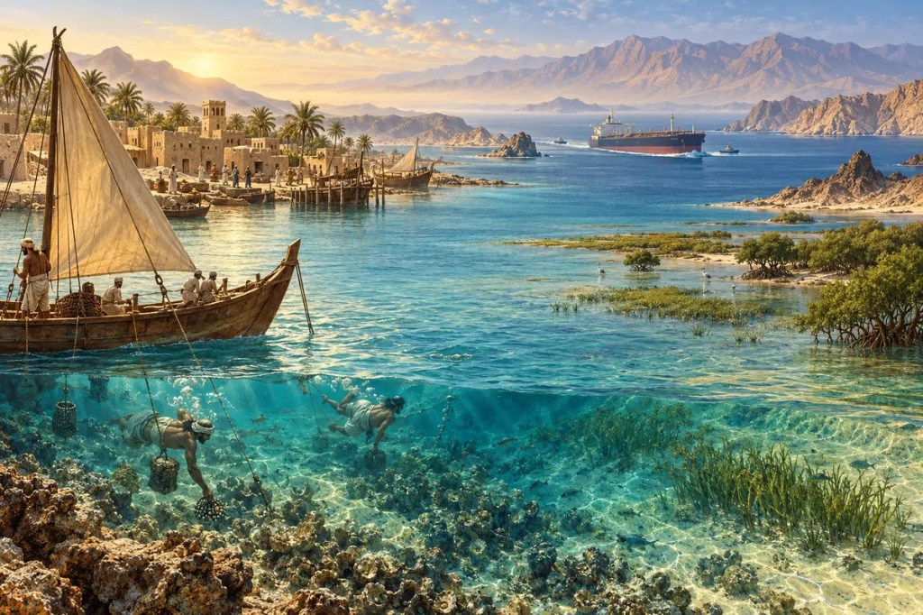
Between the Arabian Peninsula and Iran lies a warm, shallow sea that has repeatedly turned environmental limits into human opportunity. The Persian Gulf linked early civilizations, sustained pearl-diving societies, concentrated ports around scarce freshwater, and later became the maritime outlet of the world’s most influential petroleum region. Its narrow exit and fragile ecosystems make geography impossible to separate from economics or politics.
1. A Shallow Basin Between Colliding Plates
The Persian Gulf occupies a long depression between the Arabian Plate and the folded Zagros Mountains of Iran. The continuing convergence of the Arabian and Eurasian plates raised the Zagros and helped define the basin’s northeastern margin. At the northwestern end, sediment delivered by the Tigris, Euphrates, and Karun river systems built low plains and wetlands around the Shatt al-Arab.
The Gulf is exceptionally shallow, averaging only about 35 metres in depth. During the last ice age, when global sea level was much lower, much of its present floor was exposed land crossed by river channels, dunes, and plains. Rising seas entered the basin after the ice age, submerging those landscapes and creating the modern shoreline over thousands of years.
2. Heat, Evaporation, and an Extreme Sea
Arid coasts, intense summer heat, limited rainfall, and high evaporation give the Gulf unusually salty water. Less saline surface water enters through the Strait of Hormuz from the Gulf of Oman, while denser hypersaline water moves outward at depth. This reverse-estuary circulation continually exchanges the Gulf’s water with the wider Arabian Sea.
Organisms here endure large seasonal swings in temperature, high salinity, turbidity, and shallow-water heating. Yet coral communities, seagrass meadows, mangroves, tidal flats, and oyster beds support fish, turtles, dugongs, migratory birds, and coastal livelihoods. Their survival demonstrates adaptation to extremes, but it does not make them immune to rapid warming or disturbance.
3. Water, Islands, and the First Maritime Networks
Freshwater was unevenly distributed along the Gulf’s desert shores. Reliable springs, river mouths, wells, date gardens, and sheltered anchorages therefore became strategic assets. Islands such as Bahrain could serve as stepping-stones between coasts, while boats connected communities that overland deserts and mountains kept apart.
From the third millennium BCE, the civilization known as Dilmun occupied a central place in Gulf exchange. Qal’at al-Bahrain preserves evidence of a harbour and settlement that linked Mesopotamia with the Indus Valley and later with wider Indian Ocean and Mediterranean routes. Copper, timber, dates, textiles, pottery, and ideas moved through a maritime world whose scale was set by wind, water, and navigable shallows.
4. Pearls Before Petroleum
For centuries, natural pearl oysters made the Gulf’s seabed an economic landscape. Diving fleets left coastal towns during the pearling season, supported by captains, sailors, merchants, craftsmen, financiers, and markets. The work was dangerous and physically demanding, but exceptional pearls travelled through regional networks to consumers far beyond the Gulf.
Bahrain and towns such as Al Zubarah in present-day Qatar reveal how pearling shaped urban life, architecture, social hierarchy, and political power. The industry reached a peak in the late nineteenth and early twentieth centuries, then collapsed rapidly as cultured pearls entered world markets and the global depression reduced demand. Long before oil, a marine resource had already tied Gulf societies to distant economies.
5. Ports at the Crossroads of Empires
The Gulf connected the Indian Ocean to the river routes of Mesopotamia and the caravan routes of Arabia and Iran. Basra, Hormuz, Bandar Abbas, Muscat, Kuwait, and smaller ports rose or declined as channels shifted, dynasties changed, and merchants redirected trade. Dates, horses, textiles, spices, metals, ceramics, and enslaved people all passed through its harbours at different periods.
Because commerce depended on access to the sea, outside powers repeatedly tried to control ports and shipping without always conquering the interior. Portuguese, Safavid, Ottoman, British, and regional rulers competed through forts, treaties, naval patrols, and alliances. The Gulf was never simply an empty corridor: its coastal communities used imperial rivalry to preserve autonomy, redirect trade, or build new states.
6. Oil Rebuilds the Shoreline
Twentieth-century petroleum transformed the scale of Gulf settlement and infrastructure. Offshore fields, tanker terminals, refineries, pipelines, desalination plants, highways, and new cities concentrated people and capital along the coast. Oil revenues funded states and public services, while imported labour and global shipping turned modest ports into metropolitan regions.
The same geography that made export efficient also concentrated risk. Dredging, land reclamation, industrial discharge, oil spills, heated water from power plants, and brine from desalination altered shallow habitats. Around Bahrain, satellite imagery reveals submerged dunes, extensive reefs, and artificial islands in the same view—a record of both the Gulf’s geological past and its accelerated human remaking.
7. Hormuz and the Geography of Dependence
The Persian Gulf reaches the open ocean through the Strait of Hormuz, between Iran and Oman. This narrow outlet is deep and wide enough for the largest crude-oil tankers, but there is no equivalent maritime route around it. Pipelines can bypass part of the strait’s traffic, yet their combined capacity cannot replace all the oil and gas that normally moves by sea.
U.S. Energy Information Administration data show that oil flows through Hormuz averaged about 20.9 million barrels per day in the first half of 2025—roughly one-fifth of global petroleum-liquids consumption. Most crude and condensate travelled to Asian markets, and Qatar also sent large volumes of liquefied natural gas through the passage. A local bottleneck therefore carries consequences for energy prices, insurance, naval strategy, and economies thousands of kilometres away.
8. A Wealthy Coast and a Vulnerable Sea
Today the Gulf’s shallow water is asked to support shipping, fisheries, offshore energy, desalination, coastal construction, tourism, and conservation at the same time. Extreme heat and salinity already place marine life near physiological limits in some areas. Climate warming, marine heatwaves, sea-level rise, pollution, and habitat loss increase pressures that cross every political boundary.
Protection therefore depends on cooperation as much as engineering. Currents carry pollutants between states; fish, turtles, dugongs, and birds cross jurisdictions; and ports share the same narrow exit. Mangrove restoration, reef monitoring, fisheries management, cleaner industry, and careful coastal planning can reduce damage, but only if the Gulf is treated as one connected system rather than a collection of separate shorelines.
The Persian Gulf’s influence comes from contrasts: a small sea that carries global consequences, a harsh environment that sustained rich cultures, and a shallow basin whose seabed generated extraordinary wealth. Its future will depend on whether the societies transformed by that wealth can protect the waters that first connected them.
Further reading
- NASA Earth Observatory — Eight Countries, One Photo
- NASA Earth Observatory — Making Pearls in the Persian Gulf
- UNESCO — Qal’at al-Bahrain, Ancient Harbour and Capital of Dilmun
- UNESCO — Pearling, Testimony of an Island Economy
- UNESCO — Al Zubarah Archaeological Site
- U.S. Energy Information Administration — World Oil Transit Chokepoints
- ROPME — Protection of Marine Biodiversity


Leave a Reply