
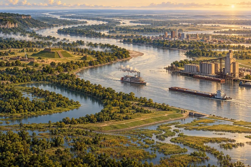
From a small lake in northern Minnesota, the Mississippi River gathers water from the center of a continent and carries it toward the Gulf coast. Along the way, it links forests, prairies, farms, cities, wetlands, and ports into one immense system. The river has nourished Indigenous civilizations, powered continental trade, supported an agricultural empire, and forced generations of engineers to negotiate with floods, sediment, and a channel that never truly stands still.
1. A Continental River Shaped by Ice
The Mississippi flows about 2,350 miles from Lake Itasca to the Gulf coast, but its power comes from a basin far larger than the river itself. Together with tributaries such as the Missouri, Ohio, Arkansas, and Red rivers, it drains roughly 1.2 million square miles—the largest river basin in the United States. Water from the Rocky Mountains, Appalachian highlands, Great Plains, and Midwest ultimately converges on the same southward route.
Much of the upper valley was reorganized during the last ice age. Glaciers blocked older drainage paths, released torrents of meltwater, and left deposits that redirected rivers across the interior. Below the confluence with the Ohio, the Mississippi enters a broad alluvial valley built from repeated layers of sand, silt, and clay. The modern river therefore follows both ancient structures in the continent and landscapes remade by ice and sediment.
2. Floodplain, Forest, and a Moving Channel
Before extensive engineering, seasonal floods spread across the valley, replenishing wetlands, backwaters, oxbow lakes, and bottomland forests. Floodwater deposited fertile sediment, opened new channels, closed old ones, and created a shifting mosaic of aquatic and terrestrial habitats. Fish used inundated forests as feeding and nursery grounds, while migratory birds followed the river corridor across North America.
This fertility came with uncertainty. Meanders migrated, banks collapsed, and settlements could find themselves stranded beside an abandoned bend or exposed to a new channel. In the lower valley, the river has repeatedly changed its path to the sea as delta lobes grew and subsided. Human communities gained rich soil and abundant water, but only by living beside a landscape capable of rearranging itself.
3. Indigenous Homelands and River Civilizations
For thousands of years, Indigenous peoples used the Mississippi and its tributaries as roads, fisheries, boundaries, and sacred landscapes. Canoes moved people and goods through a network extending from the Great Lakes to the Gulf. Floodplain soils supported maize agriculture, while forests, wetlands, and channels supplied fish, game, plants, timber, and clay.
Between about 800 and 1400 CE, Mississippian societies built large towns and ceremonial earthworks throughout the valley. Cahokia, near the meeting of the Mississippi, Missouri, and Illinois rivers, became the largest urban center in pre-Columbian North America north of Mexico. Its location joined fertile farmland with long-distance exchange routes, showing how a river junction could concentrate food, labor, authority, and ideas.
4. Colonies, Cotton, and Forced Labor
European empires recognized that control of the Mississippi meant access to the continent’s interior. Spanish, French, British, and later American authorities established forts, ports, and settlements along strategic bends and confluences. New Orleans, founded near the river’s mouth, became the gateway through which inland products entered Atlantic markets and imported goods moved upriver.
In the nineteenth century, the lower valley’s alluvial soil supported an expanding cotton economy. That wealth rested on the forced labor of enslaved African Americans and on the dispossession of Indigenous peoples. Cotton moved downriver to New Orleans and onward to textile mills in Britain and the northeastern United States, binding the river’s fertile floodplain to global finance, industrialization, and slavery.
5. Steamboats, River Cities, and Civil War
Steamboats transformed the Mississippi after the early nineteenth century. Unlike flatboats that mainly drifted downstream, steam-powered vessels could carry passengers and cargo in both directions. River cities such as St. Louis, Memphis, Vicksburg, Natchez, and New Orleans expanded as cotton, grain, timber, livestock, manufactured goods, and migrants crowded their landings.
The same corridor became a central military objective during the American Civil War. Union control of the river would divide the Confederacy and reopen a national transport route. The fall of Vicksburg in July 1863, followed by the surrender of Port Hudson, gave the Union effective command of the Mississippi. Geography turned a waterway of commerce into a strategic line whose possession altered the course of the war.
6. Engineering the River After 1927
Navigation improvements began in the nineteenth century, but the catastrophic flood of 1927 changed the scale of federal intervention. Water inundated vast areas of the lower valley and demonstrated that relying on levees alone could not safely contain the river. The Flood Control Act of 1928 authorized the Mississippi River and Tributaries Project, combining stronger levees with floodways, bank stabilization, channel works, and controlled outlets.
On the upper river, locks and dams maintain a navigation channel through a staircase of regulated pools. On the lower river, levees, revetments, wing dikes, dredging, and flood-control structures guide water and sediment past farms, towns, and ports. These works reduced some risks and made shipping more dependable, but they also separated the river from much of its floodplain and transformed habitat, sediment movement, and the consequences of extreme floods.
7. The Interior’s Maritime Highway
Today the Mississippi system remains one of the world’s great bulk-transport corridors. Barges move grain, soybeans, coal, petroleum, chemicals, fertilizer, aggregates, and other heavy cargo at costs difficult for trucks or railways to match over comparable distances. River terminals connect inland farms and factories to export facilities around Baton Rouge and New Orleans.
This efficiency also creates dependence. Low water can restrict vessel drafts and strand barges, while floods can close locks, damage terminals, and disrupt traffic. Ports, refineries, grain elevators, pipelines, railways, and highways have clustered where river and land routes meet. The channel is therefore not merely a natural feature: it is infrastructure whose changing depth influences food prices, energy supply, and international trade.
8. A Delta Starved of Its Own Sediment
The river built coastal Louisiana by overflowing its banks and distributing sediment across marshes. Levees now send much of that sediment through a confined channel into deep water, while delta soils compact and sea level rises. Louisiana has consequently lost extensive wetlands that shelter fisheries, absorb storm energy, and buffer communities. Restoration projects seek to reconnect parts of the river with sediment-starved basins, though diversions also change salinity and local ecosystems.
The basin carries another accumulated consequence downstream: excess nitrogen and phosphorus from farms, cities, and other sources. When nutrient-rich freshwater reaches the Gulf, it can fuel algal growth and contribute to a seasonal zone of low oxygen. Floodplain restoration, improved agricultural practices, wetland recovery, and coordinated nutrient management must operate across many states because the river gathers both the benefits and the costs of an entire continent.
The Mississippi River shaped civilization by joining distant landscapes into one living corridor. It created fertile soil, supported cities and cultures, carried wealth and war, and became an engineered highway of global importance. Yet every attempt to control it shifts consequences elsewhere. The river’s future depends on learning to use its power without severing the floods, sediment, wetlands, and habitats that made the valley possible.
Further reading
- National Park Service — Mississippi River Facts
- U.S. Geological Survey — Geology, Hydrology, Sediments, and Engineering of the Mississippi River
- National Park Service — Cahokia Mounds State Historic Site
- National Park Service — History and Culture of the Mississippi Delta Region
- U.S. Army Corps of Engineers — Mississippi River and Tributaries Project
- NOAA Fisheries — Upper Barataria Marsh Creation Project
- U.S. EPA — Hypoxia 101


Leave a Reply